Subscribe
61°
New Storm Threat Emerges With Separate Rounds Of Drenching Rain: Timing
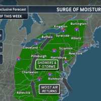
An unsettled stretch threatens to bring soaking rain throughout the Northeast, potentially resulting in a weekend washout.
New rounds of showers and thunderstorms are expected Saturday, Aug. 22, and Sunday, Aug. 23, with the potential for torrential downpours and localized flash flooding, according to the National Weather Service.
The concern is heightened in areas that were drenched Thursday, Aug. 20, including parts of eastern Pennsylvania, northern New Jersey, and western Connecticut. AccuWeather says 1 to 3 inches of rain fell in those areas, with isolated totals reaching 4 inches.
Som…
Possible Tornadoes Rip Through PA, Tearing Roofs Off School, Homes; 13 Displaced
A brief but powerful storm tore through eastern York County Thursday afternoon, Aug. 20, ripping part of the roof from Eastern York High School, damaging six townhomes, and displacing at least 13 people, according to the York County Office of Emergency Management.
The storm struck just before 4:30 p.m., with some of the worst damage reported in Lower Windsor Township, officials said.
The Pennsylvania Emergency Management Agency was closely tracking reports of tornadoes and significant damage in both York and Lancaster counties, Governor Josh Shapiro said.
"Our team at PA Emergency Man…
More Winter Weather Alerts Issued In NJ, PA As Tuesday Storm Aims At Morning Commute
Winter weather alerts have been issued across North Jersey and eastern Pennsylvania ahead of Tuesday’s storm, which is expected to bring several inches of snow and slippery roads during the morning commute, according to the National Weather Service.
A Winter Storm Watch is in effect for Sussex County, where 4 to 7 inches of snow and snowfall rates of up to 1 inch per hour are possible.
Winter Weather Advisories have been issued for Hunterdon, Morris, Warren, and Western Passaic counties, forecasters said.
In Pennsylvania, winter weather advisories cover Berks, Lehigh, Northampton, Upper Bu…
Tornado, Flood, Hail Threat As ‘Extreme Thunderstorms’ Slam Region
Wild winds, large hail, floods, and possible tornadoes may roll through the region overnight, forecasters are warning.
The National Weather Service issued a "Level 3 High Impact Severe Weather Threat" on Thursday, June 19, as storms begin hitting the area.
12:24pm CDT #SPC_MD 1364 , #njwx #pawx #dewx #mdwx #vawx #dcwx #wvwx, https://t.co/Y7ej7h7rco pic.twitter.com/q6cAaizrQk — NWS Storm Prediction Center (@NWSSPC) June 19, 2025
Officials also issued severe thunderstorm and flood warnings for parts of Virginia and western Maryland.
"Severe Thunderstorm Watch in effect for a large porti…
Ping Pong-Sized Hail, 70 MPH Winds Threaten North Jersey, Lehigh Valley
A Severe Thunderstorm Watch is in effect until 8 p.m. Tuesday, May 6, for parts of New Jersey and Pennsylvania, the National Weather Service Storm Prediction Center said.
Residents in Philadelphia, Trenton, Allentown, Reading, and across North and Central Jersey are impacted, the NWS said.
“Isolated thunderstorms have developed over portions of the region,” the National Weather Service said in a Tuesday afternoon update. “The primary threat will be for hail and damaging winds across eastern PA and northern/central NJ.”
Threats include:
Scattered hail up to ping-pong ball size
Wind gusts …
Possible Tornados, High Winds, Severe Storms Threaten Pennsylvania
A powerful storm system moving through the East Coast is expected to bring severe thunderstorms, strong winds, and the possibility of isolated tornadoes to parts of New Jersey and Pennsylvania late Sunday, March 16, into the evening, forecasters say.
According to the National Weather Service (NWS) and AccuWeather, the storm poses several risks, including:
Damaging wind gusts between 55-65 mph, with isolated gusts up to 90 mph possible.
Heavy rain leading to flash flooding in low-lying areas.
Possible isolated tornadoes, particularly in eastern Pennsylvania and the Delmarva region.
"Widespr…